North Devon Hospital – Enabling Works for BAM Construction
DLP Civils carried out surveying and drone mapping works to support early enabling and planning activities for BAM Construction at the North Devon Hospital site.
The project required accurate site control, aerial surveying, and setting out before the main construction works began.
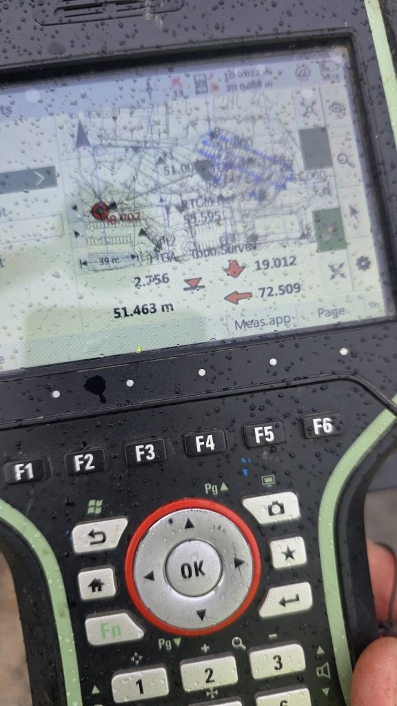
Establishing Site Control
To ensure reliable and repeatable survey data across the project, a control network was established using a traverse around the site.
Using survey-grade equipment, control points were installed and measured to provide a stable reference framework for all further surveying and setting out.
A height adjustment of 416 mm was applied to match a local datum, ensuring the project worked within the correct vertical reference system.
This allowed all future work — including drone surveys, GPS measurements, and setting out — to tie directly into OS coordinates and levels.
GPS Setting Out for Site Planning
Using GNSS equipment tied to the control network, key positions were set out on site to support the early construction planning phase.
This included:
- Proposed building footprints
- Site hoarding alignment
- Storage and compound areas
- Layout for temporary infrastructure
Accurate positioning ensured BAM could efficiently plan the layout of site facilities before construction commenced.
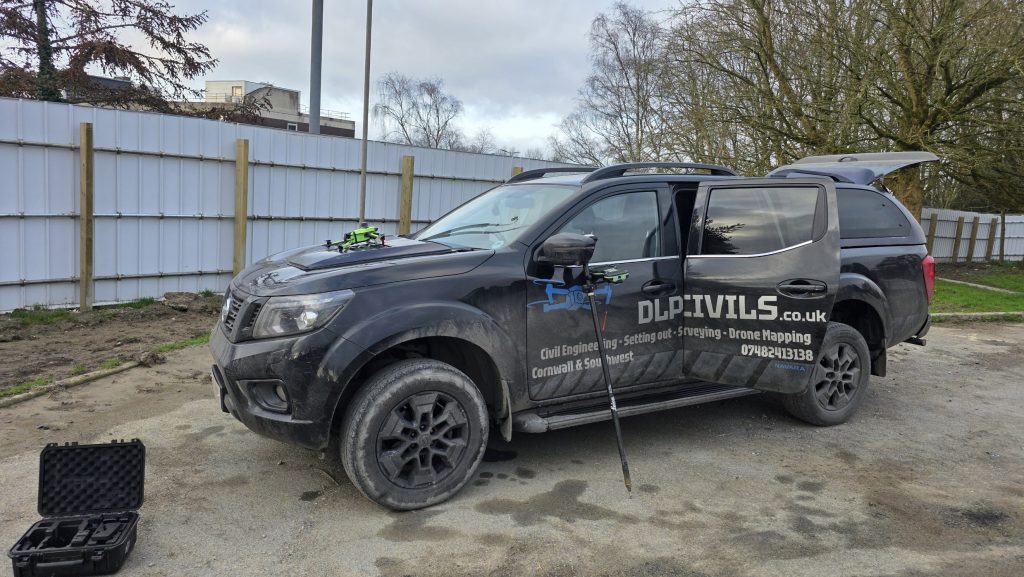
Drone Survey for Existing Levels & Stockpile Volumes
A full drone survey of the site was carried out to capture existing ground conditions and quantify material volumes.
The aerial survey generated:
- High resolution orthomosaic imagery
- 3D surface models
- Digital terrain models
- Stockpile volume calculations
These datasets allow engineers and planners to quickly understand the existing site levels and manage earthworks efficiently.
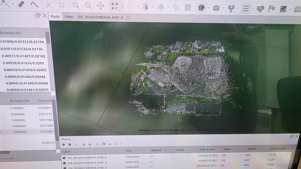
Photogrammetry Processing & 3D Model
The drone imagery was processed using photogrammetry software to generate a highly detailed 3D model of the site.
This provides a visual representation of:
- Existing terrain
- Material stockpiles
- Adjacent buildings
- Site boundaries
The data can also be exported to CAD and engineering software to assist with planning, design coordination, and progress monitoring.
Orthomosaic & Site Mapping
An orthorectified aerial map of the entire site was produced, allowing accurate measurements and planning directly from aerial imagery.
This provides a clear overview of:
- Site boundaries
- Access routes
- Material stockpiles
- Existing structures
The orthomosaic can also be integrated into AutoCAD Civil 3D or GIS platforms for further engineering analysis.
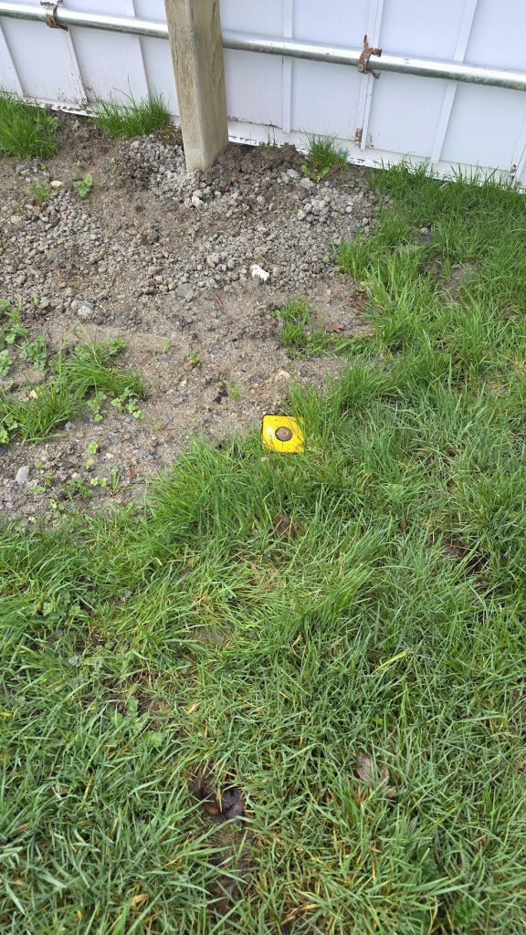
Control Points & Survey Markers
Permanent survey markers were installed around the site to maintain long-term control throughout the project.
These points allow:
- Future surveys to tie into the same coordinate system
- Contractors to check levels and positions
- Monitoring of site changes over time
Reliable site control ensures all trades work from the same reference framework.
Site Overview
The collected survey data provided BAM with accurate information for early planning decisions, helping optimise the layout of the site before major construction began.
Combining traditional surveying techniques with drone mapping allowed the project team to quickly obtain high-accuracy data while maintaining full site coverage.
Services Provided
For this project, DLP Civils delivered:
- Survey control network establishment
- Traverse adjustment
- Height adjustment to OS datum
- Drone aerial survey
- Stockpile volume calculations
- 3D photogrammetry modelling
- Orthomosaic mapping
- GPS setting out
Supporting Construction Projects Across the South West
DLP Civils provides professional surveying, setting out, and drone mapping services across Cornwall and the South West.
Our surveys support contractors, developers, and engineers with accurate data for:
- Construction planning
- Earthworks monitoring
- Topographical surveys
- Stockpile volume measurement
- As-built surveys